Exploring Vanderkloof Dam for the first time.
Do not go where the path may lead, go instead where there is no path and leave a trail.
" Ralph Waldo Emerson"
Vanderkloof Dam Solar Boat Expedition.
 |
Our expedition starting point, Vanderkloof Dam Boat Club. |
Vanderkloof Dam is the second-largest dam in South Africa (in volume), having the highest dam wall in the country at 108 metres (354 ft). The dam was commissioned in 1977; it has a capacity of 3,187.557 million cubic metres (2,584,195 acre⋅ft) and a surface area of 133.43 square kilometres (51.52 sq mi) when full.
We arrived at 👉 Vanderkloof Dam on Saturday afternoon the 8th of May 2021. Because we were doing this trip alone we were required to have a Satellite phone onboard. We also had to register our boat and had buoyancy done
Info on history, fishing 🐟 and 🐑🦓 farming 👇
https://www.vanderkloof.info/aboutvanderkloof
Weather reports predicted light winds and full sunshine for the next seven days. We packed and prepared the boat for the trip. We put the boat to water and slept in the boat in the harbor.
Met ons rit na Vanderkloofdam het ons in die vroë oggend reën op die pad ondervind. Met ons aankoms daar het die onweer opgeklaar. Die weervoorspelling was gunstig vir die daarpvolgende dae, vol-sonskyn en ligte wind. Ons het voorrade oorgepak, die boot se sisteme nagegaan en in die boot in die hawe van die Vanderkloofdam bootklub geslaap.
Ons was baie opgewonde om daar te wees, vir n baie lang tyd het ons gesê, ons moet nog eendag Vanderkloofdam gaan doen en die tyd het aangebreek!
Sewe spruite en riviere vloei in om die dam te vorm waarvan die Oranje rivier die Hoof voedbron is. Daar is die Bergrivier, Knapsakrivier, Paaiskloofspruit, Seekoeirivier, Kattegatspruit en Hondeblafrivier.
1st. Day.
Early the next morning we cruised into the main basin and headed south through a passage upstream on the original flow of the Orange River. Our contacts at Vanderkloof Dam, Louis and Derick, were visiting a farm lodge, Bankfontein Family Farm, located about 20km out on the northern shore of the second large basin in the dam. This basin has a large island situated in it's center and can be navigated around either side.
Ons het net na sonop vertrek. Uit die eerste dam stroomop vernou die waters eers en vorm dan n baie groot watermassa, mens kan skaars die vêrste oewers sien. In hierdie groot dam gedeelte is n groot eiland en daar kan of noord of suid om dit gevaar word na die res van die dam. Ons wou eerstens ons kontakpersone by Vanderkloof gaan besoek waar hulle ongeveer 20km uit op die dam by n gasteplaas vir die naweek kuier. Hulle was egter nerens te sien nie en met geen selfoon opvangs het ons besluit om vêrder te vaar aangesien ons baie goed gevorder het in die perfekte weerstoestande.
We upgraded our boat with a more powerful and efficient 24V motor, enhancing the cruising speed. Also, the large and heavy keel was removed, saving on weight and drag. When we arrived at the meeting point at about 10H30 there were no one to be seen, so we think they were only suspecting us later that afternoon. We decided to carry on with the trip as it was perfect weather for the Solar powered boat.
 |
Early morning at Vanderkloof Dam Boat Club. Stilte en kalmte het ons die eerste oggend begroet. |
 |
Our Solar Powered Boat prepared and ready. Met n potensiale een kilowatt se sonpanele vir kraglewering was ons oorgehaal om die vreemde aan te pak. |
 |
Leaving the Town of Vanderkloof behind. Die damgedeelte by die damwal is baie diep en die water is relatief skoon. |
 |
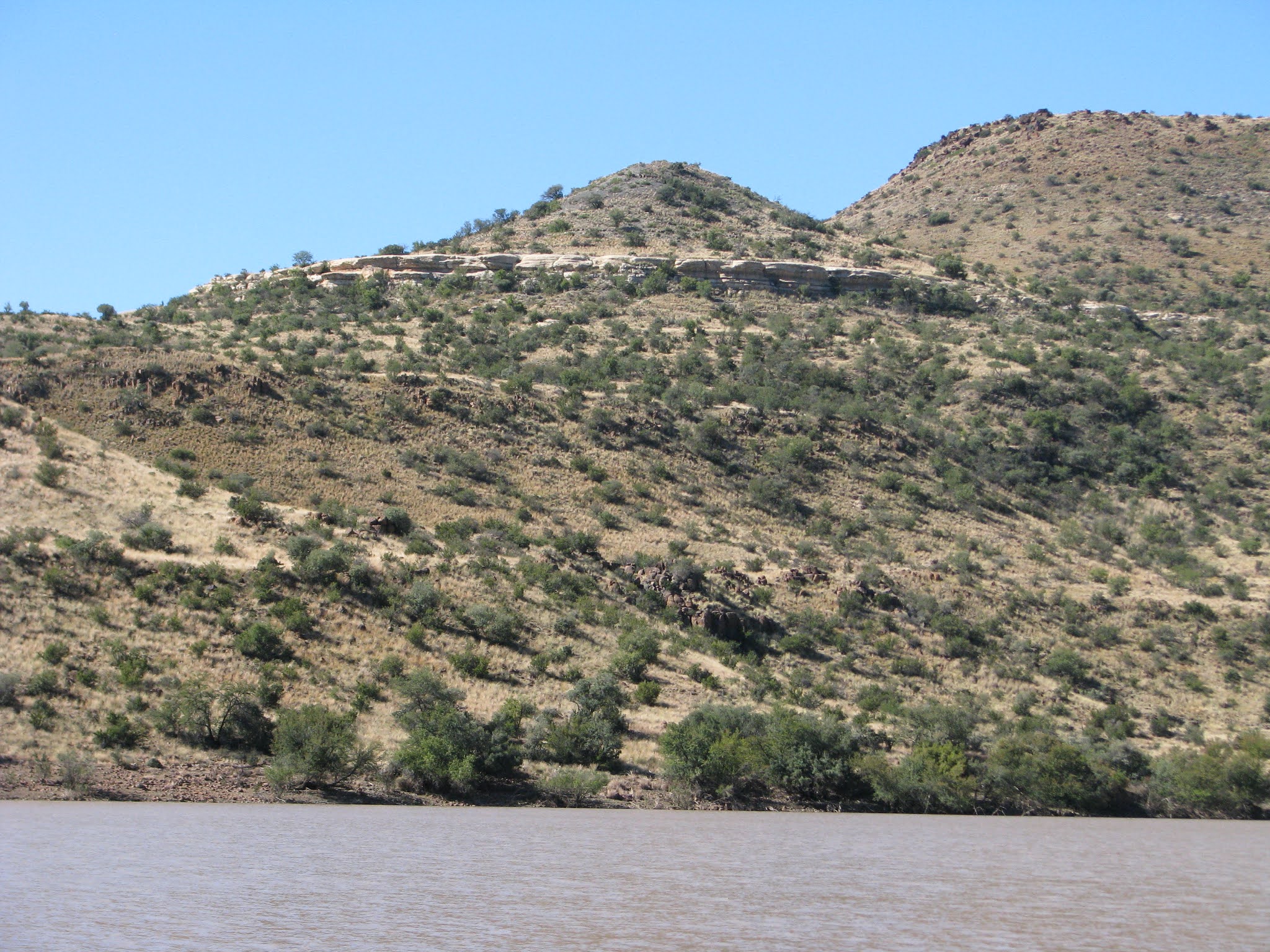
| Hills with majestic cliffs and rock formations surrounds the waters. |
 |
Ships Lady, Ronel. Sy is cool ek kalm. |
 |
Captain Solar, living his dream! |
 |
Up ahead lies a narrow passage and our gateway to the rest of the dam. |
 |
Wagtails visited us frequently hoping to find some bugs, unfortunately we cruise too slow to even hurt the bugs. |
 |
These cute birds and sometimes Dragonflies visited us on-the-go. Kwikstertjies het ons gereëld besoek. |
 |
Vanderkloof Dam forms several vast water masses. Die tweede dam stroomop is baie, baie groot! Sonder die elektroniese kaart sou mens baie maklik verdwaal! |
 |
We passed the big island in the second basin. |
 |
My navigator, Ronel, piloting the boat. Om die boot reguit te stuur verg nogal konsentrasie, maar sy het dit gou bemeester. |
 |
She is also the head chef, preparing a meal-on-the-go. In die luuksheid van die klein Sonjag het Ronél vir ons heerlike maaltye voorberei. |
 |
Almost everywhere the shoreline ends onto hills. Om elke draai was daar nuwe berge en koppe om te aanskou. Opvallend was die baie "Klipvalle", breë stroke kaal klippe wat soos watervalle teen die randte se kante lê. |
 |
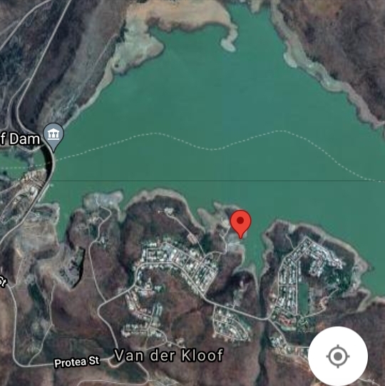
Satellite image of our 1st day's stop-over point.(Red pin) |
 |
Closer image of our camping spot. |
 |
As this was our first night out on the dam we named it "Lune's Bay" |
 |
Ronel relaxing on some of natures rock statues. Moeder natuur het vir ons n unieke kampplek gelaat. |
 |
With barely enough room between the rocks we managed to safely dock the boat. Wat goed werk is om reguit, baie stadig in te vaar tot die boot die oewer met sy voorkant raak. Só bly dit veilig diep vir die motor se propeller agter. Daarna draai ek die boot per hand om sodat die agterkant so naby as moontlik aan die wal is. |
 |
Evidence of wild life everywhere. |
 |
Driftwood ensured nice campfires. Afhangende van hoe skuins die grond langs die water is, is daar gewoonlik n lekker groot afstand tot by die hoogwater waterlyn merk. Dié strand gedeelte is waar ons geregtig is om op te kamp. Dis of sand, verweerde fyn klip of partykeer nét klippe. Daar is geen gras nie en dus is dit n veilige plek vir vuurmaak. |
 |
We came well prepared. Dié plastiese emmer met n "swem noodle" as sitpkek was n uitstekende gemaklike 🚻. |
 |
Early morning at Lune's Bay. Vroegoggende is baie spesiaal op die dam. |
2nd. Day.
From Lune's Bay we cruised in the upstream direction. Again weather was just perfect, the hills became taller and the rocky outcrops on top were beautiful with interesting shapes. Pace was good and we reached the last of the basins, some 65km's upstream from the dam wall at 13H00. Firstly we explored the western shoreline to find a safe docking spot for the night. After finding a nice spot we docked, stretched our legs and then set off immediately to where the Orange River flows into this first basin to form the Vanderkloof Dam.

 |
This is what we came to experience! Geen foto of woorde kan behoorlik beskryf hoe uniek en mooi dit daar was nie. |
 |
The passage where the Orange river enters the 1st basin. |
 |
Interesting ever changing rocky outcrops. |
 |
Perfect cruising conditions. |
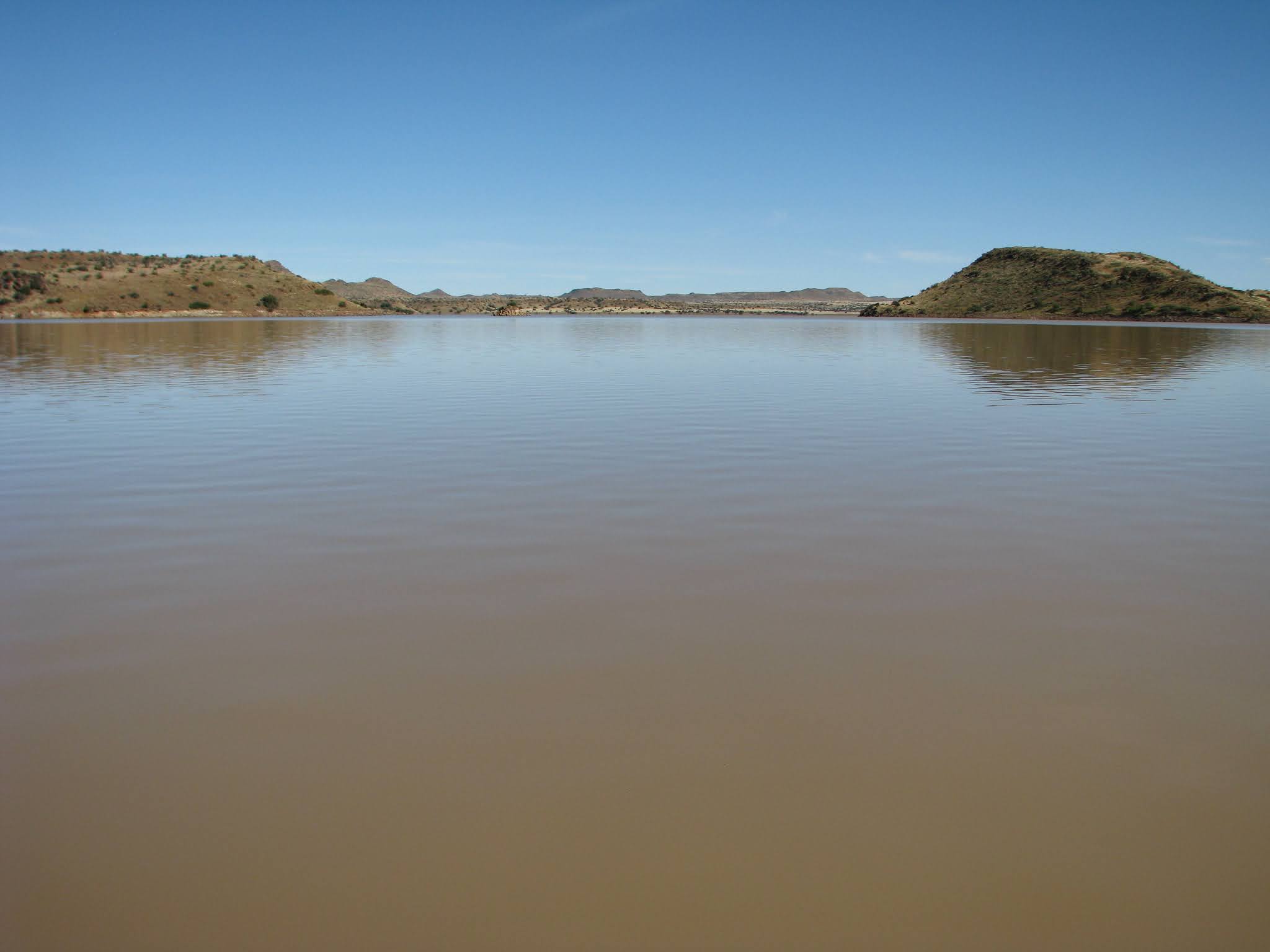 |
The basins forms vast water masses. |


 |
Hammer head nature statue. |


 |
The ever changing landscape was awesome to watch. |
 |
When Navigating these waters one must be exactly sure of your position, getting lost here can be easy. |
 |
Western shoreline in the large first basin of VDKD. This Basin lies 65km's from the Dam wall. |
 |
A perfect spot in the first basin of VDKD. Fyn verweerde klip het n ideale strand gevorm om teen te dok. n Tiepe alge het n mooi groen-blou streep op die strand gelaat. |
 |
Relaxing after a special day. Rus en vrede! |
 |
Tranquility. |
 |
A Monitor Lizard's track near our camp. |
 |
Our Camping spot the second day. |
 |
Our camping spot(Red pin) left and to the right is where the Orange River flows in to form the 1st Basin in Vanderkloof Dam. |
 |
We followed the Seekoeirivier out and back. |
 |
Old bonsai like trees growing on the rocks. |
 |
We saw only one boat with 3 occupants passed us on the 3rd. day. |
 |
Animals were difficult to spot, but we did see some Blue Wildebeest, Kudu and Gemsbok. |

 |
Eagles and Fish Eagles were spotted frequently. |
 |
Although there were long shadows the Solar Electric Propulsion System performed very well for this time of year. |


 |
Bushveld TV. |
 |
With the keel removed we could dock the boat near enough to the shore so that we could exit the boat onto dry land. |
 |
A Photographers dream. |
 |
We found a nice sheltered bay to camp in on the 3rd night. |


 |
The second last Basin is very large. Wyd lê die vlaktes ver teen die hang, sag op die oor is die gekabbel van water, wind en voëls se sang. |
 |
Here the Basin stretches right to the horizon. Die wateroppervlak strek oor 133.4 vierkante km. Hier is n deel van die 3.2 miljoen kubieke meter water. |

 |
My Right Hand! |
 |
Curious visitor to our camp. |
 |
The shallow waters prevented us to dock close to the shore. Partykeer is dit net té vlak om tot teen die kant te stop. Ons gebruik dan ons waterboots om oor die klippers te loop en die voete droog te hou. |
 |
Ronel still had the freedom feeling! |
 |
The mini braai on the boat. |
 |
Filling in the ships log. |
 |
Again piece and tranquility in the sheltered bay. |
 |
Our camping spot near the harbour. |
 |
Close-up view of our hiding place. |
5th Day.

 |
Gensbok spotted on the hills. |


 |
When we reached the main Basin in Vanderkloof the water was mirror smooth and we just had to circle wide in it towards the Boat Club. |
 |
In the Main Basin, Vanderkloof Town in the background. |
 |
Vanderkloof Dam Main Basin, Dam Wall, Town Rolfontein and the Boat Club Harbour. |


What a fantastic experience and beautiful photos! What a unique and relaxing way of exploring our dams using only solar power. Thanks.
ReplyDeleteThank you Frank. We really got the feeling out there that we were the very first ones to explore the vast remote area. With our relatively slow speed and almost silent cruise we had time to fully absorb the unspoiled scenery.
ReplyDelete